|
search place name
|
||
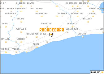
Roda de Bará (Cataluña, Spain)Roda de Bará is a town in the Cataluña region of Spain. An overview map of the region around Roda de Bará is displayed below.
regional and 3d topo map of Roda de Bará, Spain ::
nearby GPS traces from timatio ::
Roda de Bará airports ::
The nearest airport is REU - Reus, located 25.4 km west of Roda de Bará.
Other airports nearby include BCN - Barcelona (52.8 km east), LEU - Seo De Urgel (128.4 km north), GRO - Gerona Girona (134.2 km north east), PGF - Perpignan Rivesaltes (208.5 km north east), Nearby towns ::
Creixell (2.3km south west) //
Bonastre (4.0km north) //
Pobla de Montornés (4.2km west) //
San Vicente de Calders (4.6km north east) //
La Marina (5.6km south west) //
Clará (5.6km south west) //
Albiñana (7.5km north) //
Vendrell (6.7km north east) //
Las Pesas (7.9km north) //
Torredembarra (6.7km south west) //
Masarbonés (7.9km north) //
[all distances 'as the bird flies' and approximate] 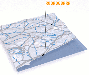 Places with similar names to Roda de Bará, Spain :: Disclaimer :: Information on this page comes without warranty of any kind |
||
|
Where is Roda de Bará? Elevation and coordinates ::
Latitude (lat): 41°11'0"N Longitude (lon): 1°28'0"E
Elevation (approx.): 42m (map arrows pan, magnifying glasses zoom) |
||
|
Visiting Roda de Bará? Hotel/Accommodation ::
Book a hotel in Roda de Bará Travel Guide ::
Buy a travel guide for Spain rental cars ::
car rental offers GPS waypoint ::
download a GPX waypoint (PoI) of Roda de Bará for your GPS receiver
|
||