|
search place name
|
||
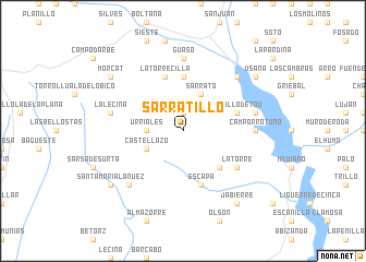
Sarratillo (Aragón, Spain)Sarratillo is a town in the Aragón region of Spain. An overview map of the region around Sarratillo is displayed below.
regional and 3d topo map of Sarratillo, Spain ::
Sarratillo airports ::
The nearest airport is LDE - Tarbes Lourdes, located 92.5 km north of Sarratillo.
Other airports nearby include LEU - Seo De Urgel (107.9 km east), ZAZ - Zaragoza Ab (121.3 km south west), PUF - Pau Pyrenees (122.0 km north), PNA - Pamplona (150.8 km west), Nearby towns ::
Santa María de Buil (1.9km north) //
Urriales (2.7km west) //
Sarrato (4.0km north) //
Castellazo (3.3km south west) //
Castejón de Sobrarbe (4.6km south east) //
El Grado (5.6km north) //
Latorrecilla (5.7km north) //
Morillo de Tou (4.5km north east) //
Escapa (5.7km south) //
Latorre (5.5km south east) //
Guaso (7.4km north) //
Camporrotuno (5.5km east) //
La Lecina (5.8km west) //
Coscojuela de Sobrarbe (5.8km east) //
Aínsa (6.9km north east) //
Paúles (6.9km south west) //
Morcat (7.8km north west) //
Usana (7.8km north east) //
Jabierre (8.5km south east) //
Santa María Lanuez (7.8km south west) //
[all distances 'as the bird flies' and approximate] 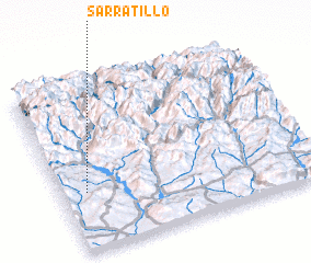 Places with similar names to Sarratillo, Spain ::
Disclaimer :: Information on this page comes without warranty of any kind |
||
|
Where is Sarratillo? Elevation and coordinates ::
Latitude (lat): 42°21'0"N Longitude (lon): 0°6'0"W
Elevation (approx.): 878m (map arrows pan, magnifying glasses zoom) |
||
|
Visiting Sarratillo? Hotel/Accommodation ::
Book a hotel in Sarratillo Travel Guide ::
Buy a travel guide for Spain rental cars ::
car rental offers GPS waypoint ::
download a GPX waypoint (PoI) of Sarratillo for your GPS receiver
|
||