|
search place name
|
||
Tanda (Asturias, Spain)Tanda is a town in the Asturias region of Spain. An overview map of the region around Tanda is displayed below.
regional and 3d topo map of Tanda, Spain ::

Tanda airports ::
The nearest airport is OVD - Aviles Asturias, located 78.8 km north west of Tanda.
Other airports nearby include SDR - Santander (114.8 km east), VLL - Valladolid (168.4 km south), BGC - Braganca (193.8 km south west), Nearby towns ::
Abiegos (1.4km east) //
Taranes (1.4km west) //
Beleño (2.7km east) //
Carangas (3.9km north) //
Sobrefoz (4.6km south east) //
Tribierto (5.6km north) //
Sellaño (5.6km north) //
Priesca (7.4km north) //
Cazo (7.4km north) //
Cirieño (7.4km north) //
Ambingue (7.5km north) //
Eno (7.5km north) //
Valle del Moro (6.9km north west) //
Pendones (6.9km south west) //
Pen (7.9km north) //
La Foz (7.8km south west) //
Villaverde (9.2km north east) //
Santillán (9.2km north east) //
Sames (9.2km north east) //
[all distances 'as the bird flies' and approximate] 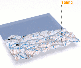 Places with similar names to Tanda, Spain ::
Disclaimer :: Information on this page comes without warranty of any kind |
||
|
Where is Tanda? Elevation and coordinates ::
Latitude (lat): 43°12'0"N Longitude (lon): 5°12'0"W
Elevation (approx.): 590m (map arrows pan, magnifying glasses zoom) |
||
|
Visiting Tanda? Hotel/Accommodation ::
Book a hotel in Tanda Travel Guide ::
Buy a travel guide for Spain rental cars ::
car rental offers GPS waypoint ::
download a GPX waypoint (PoI) of Tanda for your GPS receiver
|
||