|
search place name
|
||
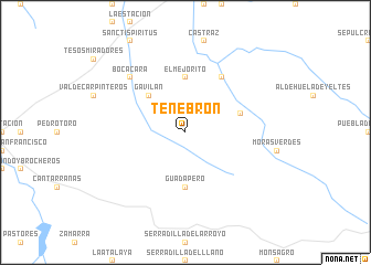
Tenebrón (Castilla y León, Spain)Tenebrón is a town in the Castilla y León region of Spain. An overview map of the region around Tenebrón is displayed below.
regional and 3d topo map of Tenebrón, Spain ::
Tenebrón airports ::
The nearest airport is SLM - Salamanca, located 80.7 km north east of Tenebrón.
Other airports nearby include VRL - Vila Real (136.6 km north west), BGC - Braganca (141.1 km north), VLL - Valladolid (174.5 km north east), BJZ - Badajoz Talavera La Real (195.8 km south), Nearby towns ::
Gavilán (4.7km north west) //
El Mejorito (5.6km north) //
Guadapero (5.6km south) //
Dios le Guarde (4.6km north east) //
Alba de Yeltes (6.2km north east) //
Bocacara (7.0km north west) //
[all distances 'as the bird flies' and approximate] 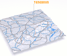 Places with similar names to Tenebrón, Spain ::
// Donnbronn (DE)
// Danaburan (TR)
// Dānbārān (IR)
// Dan Barno (NE)
// Deni Birni (NG)
// Tanybryn (AU)
// Dunbrin (IE)
// Dunbyrne (IE)
// Doniaburen (NL)
Disclaimer :: Information on this page comes without warranty of any kind |
||
|
Where is Tenebrón? Elevation and coordinates ::
Latitude (lat): 40°37'0"N Longitude (lon): 6°21'0"W
Elevation (approx.): 827m (map arrows pan, magnifying glasses zoom) |
||
|
Visiting Tenebrón? Hotel/Accommodation ::
Book a hotel in Tenebrón Travel Guide ::
Buy a travel guide for Spain rental cars ::
car rental offers GPS waypoint ::
download a GPX waypoint (PoI) of Tenebrón for your GPS receiver
|
||