|
search place name
|
||
Todolella (Comunidad Valenciana, Spain)Todolella is a town in the Comunidad Valenciana region of Spain. An overview map of the region around Todolella is displayed below.
regional and 3d topo map of Todolella, Spain ::

Todolella airports ::
The nearest airport is VLC - Valencia, located 130.4 km south of Todolella.
Other airports nearby include ZAZ - Zaragoza Ab (131.0 km north west), REU - Reus (131.6 km north east), LEU - Seo De Urgel (233.2 km north east), IBZ - Ibiza (241.4 km south east), Nearby towns ::
La Mata de Morrella (4.0km south) //
Forcall (4.2km east) //
Freixameno (5.6km south east) //
Mas de Sorolla (6.2km south west) //
Villores (5.6km north east) //
Luco de Bordón (6.2km north west) //
La Cuba (7.9km south) //
Cinctorres (7.9km south) //
Bordón (6.7km north west) //
[all distances 'as the bird flies' and approximate] 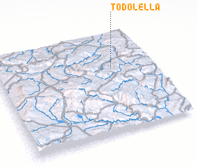 Places with similar names to Todolella, Spain ::
// Taddia Lola (ET)
// Tetelilla (MX)
// Tatle Ali (PK)
// Tudelilla (ES)
// Tête à lʼÎle (HT)
// Didi Lilo (GE)
// Tiétiélilié (CI)
Disclaimer :: Information on this page comes without warranty of any kind |
||
|
Where is Todolella? Elevation and coordinates ::
Latitude (lat): 40°39'0"N Longitude (lon): 0°15'0"W
Elevation (approx.): 820m (map arrows pan, magnifying glasses zoom) |
||
|
Visiting Todolella? Hotel/Accommodation ::
Book a hotel in Todolella Travel Guide ::
Buy a travel guide for Spain rental cars ::
car rental offers GPS waypoint ::
download a GPX waypoint (PoI) of Todolella for your GPS receiver
|
||