|
search place name
|
||
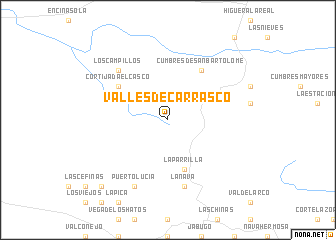
Valles de Carrasco (Andalucía, Spain)Valles de Carrasco is a town in the Andalucía region of Spain. An overview map of the region around Valles de Carrasco is displayed below.
regional and 3d topo map of Valles de Carrasco, Spain ::
Valles de Carrasco airports ::
The nearest airport is BJZ - Badajoz Talavera La Real, located 95.4 km north of Valles de Carrasco.
Other airports nearby include SVQ - Sevilla (102.9 km south east), OZP - Sevilla Moron Ab (139.3 km south east), FAO - Faro (155.0 km south west), XRY - Jerez (156.1 km south east), Nearby towns ::
La Parrilla (5.7km south) //
Cumbres de San Bartolomé (6.3km north east) //
Cortijada El Casco (5.7km north west) //
La Nava (7.6km south) //
Los Campillos (7.1km north west) //
Puerto-Lucía (8.0km south) //
Los Andreses (9.4km south west) //
Los Bravos (9.4km south west) //
[all distances 'as the bird flies' and approximate] 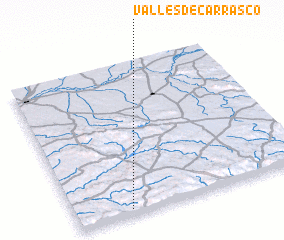 Places with similar names to Valles de Carrasco, Spain :: Disclaimer :: Information on this page comes without warranty of any kind |
||
|
Where is Valles de Carrasco? Elevation and coordinates ::
Latitude (lat): 38°2'0"N Longitude (lon): 6°46'0"W
Elevation (approx.): 459m (map arrows pan, magnifying glasses zoom) |
||
|
Visiting Valles de Carrasco? Hotel/Accommodation ::
Book a hotel in Valles de Carrasco Travel Guide ::
Buy a travel guide for Spain rental cars ::
car rental offers GPS waypoint ::
download a GPX waypoint (PoI) of Valles de Carrasco for your GPS receiver
|
||