|
search place name
|
||
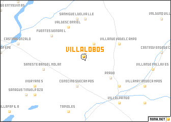
Villalobos (Castilla y León, Spain)Villalobos is a town in the Castilla y León region of Spain. An overview map of the region around Villalobos is displayed below.
regional and 3d topo map of Villalobos, Spain ::
Villalobos airports ::
The nearest airport is VLL - Valladolid, located 57.8 km south east of Villalobos.
Other airports nearby include BGC - Braganca (103.4 km west), SLM - Salamanca (110.9 km south), OVD - Aviles Asturias (185.2 km north), SDR - Santander (212.4 km north east), Nearby towns ::
Vega de Villalobos (1.9km north) //
Quintanilla del Molar (4.0km north) //
Cerecinos de Campos (5.7km south) //
Prado (5.6km south east) //
Villanueva del Campo (6.6km north east) //
Valdescorriel (7.9km north) //
Fuentes de Ropel (7.8km north west) //
Quintanilla del Olmo (7.8km south east) //
[all distances 'as the bird flies' and approximate]  Places with similar names to Villalobos, Spain ::
// Villalobos (PA)
// Villalobos (PA)
// Vila Lobos (PT)
// Valea lui Bosie (RO)
// Villalbos (ES)
// Villalobos (PE)
// Villy-le-Bois (FR)
// Villy-le-Bas (FR)
// Villalobos (MX)
// Villa Lobos (DO)
Disclaimer :: Information on this page comes without warranty of any kind |
||
|
Where is Villalobos? Elevation and coordinates ::
Latitude (lat): 41°57'0"N Longitude (lon): 5°28'0"W
Elevation (approx.): 737m (map arrows pan, magnifying glasses zoom) |
||
|
Visiting Villalobos? Hotel/Accommodation ::
Book a hotel in Villalobos Travel Guide ::
Buy a travel guide for Spain rental cars ::
car rental offers GPS waypoint ::
download a GPX waypoint (PoI) of Villalobos for your GPS receiver
|
||