|
search place name
|
||
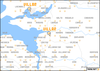
Villar (Galicia, Spain)Villar is a town in the Galicia region of Spain. An overview map of the region around Villar is displayed below.
regional and 3d topo map of Villar, Spain ::
Villar airports ::
The nearest airport is LCG - La Coruna A Coruna, located 20.2 km south west of Villar.
Other airports nearby include SCQ - Santiago (59.5 km south), VGO - Vigo (135.1 km south), BGC - Braganca (209.0 km south east), Nearby towns ::
Puentedeume (0.0km north) //
Breamo (1.3km west) //
Noguerosa (1.3km east) //
Porto (1.9km north) //
Andrade (1.9km south) //
Centroña (2.3km north west) //
Cabañas (2.3km north east) //
Carantoña (3.7km south) //
Hombre (2.7km east) //
Castro (3.9km south) //
Limodre (3.9km north) //
Villanueva (3.3km south west) //
Laraje (3.9km north) //
Doroña (3.3km south east) //
Erines (3.3km north east) //
Redes (4.1km north west) //
Piñeiro (4.6km north west) //
Caamouco (4.6km north west) //
Punta Bañobre (4.7km south west) //
Leiro (5.7km south) //
Barallobre (5.7km north) //
Villarmayor (5.7km south) //
Boebre (4.4km south west) //
Perbes (4.4km south west) //
Grandal (4.4km south east) //
Magalofes (5.7km north) //
Fene (5.7km north) //
Miño (6.2km south west) //
Salto (6.2km north east) //
[all distances 'as the bird flies' and approximate] 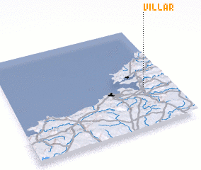 Places with similar names to Villar, Spain ::
Disclaimer :: Information on this page comes without warranty of any kind |
||
|
Where is Villar? Elevation and coordinates ::
Latitude (lat): 43°24'0"N Longitude (lon): 8°10'0"W
Elevation (approx.): 90m (map arrows pan, magnifying glasses zoom) |
||
|
Visiting Villar? Hotel/Accommodation ::
Book a hotel in Villar Travel Guide ::
Buy a travel guide for Spain rental cars ::
car rental offers GPS waypoint ::
download a GPX waypoint (PoI) of Villar for your GPS receiver
|
||