|
search place name
|
||
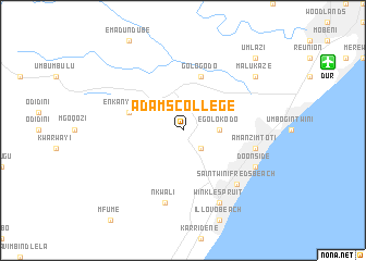
Adams College (KwaZulu-Natal, South Africa)Adams College is a town in the KwaZulu-Natal region of South Africa. An overview map of the region around Adams College is displayed below.
regional and 3d topo map of Adams College, South Africa ::
Adams College airports ::
The nearest airport is DUR - Durban Intl, located 14.7 km north east of Adams College.
Other airports nearby include VIR - Durban Virginia (37.3 km north east), PZB - Pietermaritzburg (58.7 km north west), MGH - Margate (102.1 km south west), RCB - Richard's Bay Richards Bay (189.3 km north east), Nearby towns ::
KwaMakhutha (2.5km south east) //
Egolokodo (3.2km east) //
Gologodo (5.8km north) //
Enkanyisweni (5.2km west) //
Amanzimtoti (6.7km east) //
Nkwali (7.6km south) //
Warner Beach (7.4km south east) //
Kingsborough (7.4km south east) //
Saint Winifredʼs Beach (7.4km south east) //
Doonside (7.4km south east) //
Winklespruit (8.1km south east) //
Malukaze (8.5km north east) //
Umlazi (9.8km north east) //
[all distances 'as the bird flies' and approximate] 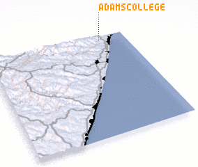 Places with similar names to Adams College, South Africa :: Disclaimer :: Information on this page comes without warranty of any kind |
||
|
Where is Adams College? Elevation and coordinates ::
Latitude (lat): 30°2'0"S Longitude (lon): 30°49'0"E
Elevation (approx.): 143m (map arrows pan, magnifying glasses zoom) |
||
|
Visiting Adams College? Hotel/Accommodation ::
Book a hotel in Adams College Travel Guide ::
rental cars ::
car rental offers GPS waypoint ::
download a GPX waypoint (PoI) of Adams College for your GPS receiver
|
||