|
search place name
|
||
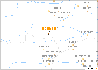
Bowden (South Africa)Bowden is a town in South Africa. An overview map of the region around Bowden is displayed below.
regional and 3d topo map of Bowden, South Africa ::
Bowden airports ::
The nearest airport is UTT - Umtata Mthatha, located 101.0 km south east of Bowden.
Other airports nearby include MSU - Maseru Moshoeshoe I Intl (154.1 km north west), UTW - Queenstown (181.8 km south west), BFN - Bloemfontein Intl (258.2 km north west), Nearby towns ::
Philipsrust (2.4km north east) //
Glen Avice (5.8km south) //
Tinana (7.6km north) //
Elands Heights (7.6km south) //
Ncambalala (7.3km north east) //
Msingizane (8.1km north east) //
Thabakhubelu (9.8km north east) //
[all distances 'as the bird flies' and approximate] 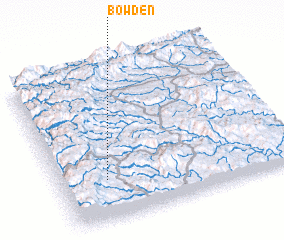 Places with similar names to Bowden, South Africa ::
Disclaimer :: Information on this page comes without warranty of any kind |
||
|
Where is Bowden? Elevation and coordinates ::
Latitude (lat): 30°44'0"S Longitude (lon): 28°12'0"E
Elevation (approx.): 1953m (map arrows pan, magnifying glasses zoom) |
||
|
Visiting Bowden? Hotel/Accommodation ::
Book a hotel in Bowden Travel Guide ::
rental cars ::
car rental offers GPS waypoint ::
download a GPX waypoint (PoI) of Bowden for your GPS receiver
|
||