|
search place name
|
||
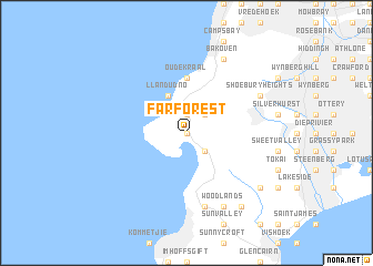
Far Forest (South Africa)Far Forest is a town in South Africa. An overview map of the region around Far Forest is displayed below.
regional and 3d topo map of Far Forest, South Africa ::
Far Forest airports ::
The nearest airport is CPT - Cape Town Intl, located 24.5 km east of Far Forest.
Nearby towns ::
Houtbaai (0.0km north) //
Monteray (1.9km north) //
Vredehoek (2.4km north east) //
An-de-Waterkant (2.4km south east) //
Llandudno (4.0km north west) //
Oudekraal (5.6km north) //
Flat Acres (7.6km south) //
Noordhoek (7.6km south) //
Bakoven (8.0km north east) //
Wattle Park (8.0km south) //
High Riding (8.0km south) //
Woodlands (8.0km south) //
Good Hope (8.0km south) //
Shoebury Heights (7.2km north east) //
Belle Ombre (7.2km north east) //
Klein Steenberg (8.3km south east) //
Brookwood (8.7km south east) //
Groot Silwermyn (8.7km south east) //
[all distances 'as the bird flies' and approximate] 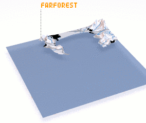 Places with similar names to Far Forest, South Africa ::
// Fairforest (US)
// Fairforest (US)
Disclaimer :: Information on this page comes without warranty of any kind |
||
|
Where is Far Forest? Elevation and coordinates ::
Latitude (lat): 34°2'0"S Longitude (lon): 18°21'0"E
Elevation (approx.): 17m (map arrows pan, magnifying glasses zoom) |
||
|
Visiting Far Forest? Hotel/Accommodation ::
Book a hotel in Far Forest Travel Guide ::
rental cars ::
car rental offers GPS waypoint ::
download a GPX waypoint (PoI) of Far Forest for your GPS receiver
|
||