|
search place name
|
||
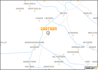
Gaataan (South Africa)Gaataan is a town in South Africa. An overview map of the region around Gaataan is displayed below.
regional and 3d topo map of Gaataan, South Africa ::
Gaataan airports ::
The nearest airport is PTG - Pietersburg, located 78.4 km north of Gaataan.
Other airports nearby include LTA - Tzaneen (123.0 km north east), HDS - Hoedspruit Afb (159.7 km east), PRY - Pretoria Wonderboom (171.3 km south west), PHW - Phalaborwa (184.9 km north east), Nearby towns ::
Thabanapitsi (1.9km north) //
Tswatago (5.0km south west) //
La Dinong (5.6km north) //
Leswika (6.5km north west) //
Van der Merwes Kraal (6.3km south west) //
Serageng (7.5km south west) //
Malope (9.0km north east) //
Ga-Masukulale (9.0km south east) //
[all distances 'as the bird flies' and approximate] 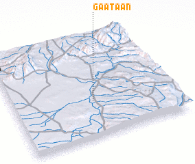 Places with similar names to Gaataan, South Africa ::
Disclaimer :: Information on this page comes without warranty of any kind |
||
|
Where is Gaataan? Elevation and coordinates ::
Latitude (lat): 24°38'0"S Longitude (lon): 29°30'0"E
Elevation (approx.): 822m (map arrows pan, magnifying glasses zoom) |
||
|
Visiting Gaataan? Hotel/Accommodation ::
Book a hotel in Gaataan Travel Guide ::
rental cars ::
car rental offers GPS waypoint ::
download a GPX waypoint (PoI) of Gaataan for your GPS receiver
|
||