|
search place name
|
||
Hlogotlou (South Africa)Hlogotlou is a town in South Africa. An overview map of the region around Hlogotlou is displayed below.
regional and 3d topo map of Hlogotlou, South Africa ::

Hlogotlou airports ::
The nearest airport is PTG - Pietersburg, located 124.5 km north of Hlogotlou.
Other airports nearby include LTA - Tzaneen (143.2 km north east), HDS - Hoedspruit Afb (146.8 km north east), PRY - Pretoria Wonderboom (172.1 km south west), SZK - Skukuza (182.4 km east), Nearby towns ::
Talane (0.0km north) //
Spitskop (0.0km north) //
Makpopeng (2.5km north east) //
Mmotwaneng (3.8km north west) //
Magukubjane (3.8km north east) //
Ga-Phetla (5.0km north east) //
Mpudulle (5.0km west) //
Lebaleng (5.8km north) //
Dindela (6.3km south west) //
Ga-Madiba (6.3km north west) //
Thabaleboto (7.0km west) //
Monsterlus (7.0km west) //
Mahlangu (7.0km west) //
Mare (7.5km north east) //
Ngwaritsi (8.1km north east) //
Khathazweni (9.0km south west) //
Gopeng (9.0km north west) //
[all distances 'as the bird flies' and approximate] 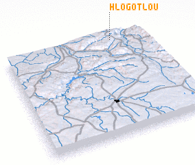 Places with similar names to Hlogotlou, South Africa ::
// Luuk Talay (PH)
// Luuk Tulay (PH)
// La Cadolla (ES)
// Lakhtela (RU)
// Lakhtela (RU)
// Lukhtala (RU)
// Lakedale (US)
// Lockdale (US)
// Lickdale (US)
// La Guatilla (CO)
Disclaimer :: Information on this page comes without warranty of any kind |
||
|
Where is Hlogotlou? Elevation and coordinates ::
Latitude (lat): 25°1'0"S Longitude (lon): 29°47'0"E
Elevation (approx.): 1538m (map arrows pan, magnifying glasses zoom) |
||
|
Visiting Hlogotlou? Hotel/Accommodation ::
Book a hotel in Hlogotlou Travel Guide ::
rental cars ::
car rental offers GPS waypoint ::
download a GPX waypoint (PoI) of Hlogotlou for your GPS receiver
|
||