|
search place name
|
||
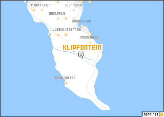
Klipfontein (South Africa)Klipfontein is a town in South Africa. An overview map of the region around Klipfontein is displayed below.
regional and 3d topo map of Klipfontein, South Africa ::
Klipfontein airports ::
The nearest airport is CPT - Cape Town Intl, located 35.2 km north east of Klipfontein.
Nearby towns ::
Klaasjagersberg (2.4km north west) //
Rocklands (4.0km north) //
Oatlands (5.8km north) //
The Boulders (5.8km north) //
Murdoch Valley (5.8km north) //
Brightwater (6.3km south west) //
Wildeschutsbrand (6.3km north west) //
Seaforth (7.4km north) //
Simonʼs Town (7.4km north) //
Kilfinan (7.2km north west) //
Kogelfontein (7.2km north west) //
Scarborough (8.3km north west) //
[all distances 'as the bird flies' and approximate]  Places with similar names to Klipfontein, South Africa ::
// Klipfontein (ZA)
// Klipfontein (ZA)
// Klipfontein (ZA)
// Klipfontein (ZA)
// Klipfontein (ZA)
// Klipfontein (ZA)
// Klipfontein (ZA)
// Klipfontein (NA)
Disclaimer :: Information on this page comes without warranty of any kind |
||
|
Where is Klipfontein? Elevation and coordinates ::
Latitude (lat): 34°15'0"S Longitude (lon): 18°26'0"E
Elevation (approx.): 104m (map arrows pan, magnifying glasses zoom) |
||
|
Visiting Klipfontein? Hotel/Accommodation ::
Book a hotel in Klipfontein Travel Guide ::
rental cars ::
car rental offers GPS waypoint ::
download a GPX waypoint (PoI) of Klipfontein for your GPS receiver
|
||