|
search place name
|
||
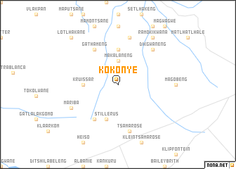
Kokonye (South Africa)Kokonye is a town in South Africa. An overview map of the region around Kokonye is displayed below.
regional and 3d topo map of Kokonye, South Africa ::
Kokonye airports ::
The nearest airport is VRU - Vryburg, located 87.8 km east of Kokonye.
Other airports nearby include SIS - Sishen (99.7 km south west), KIM - Kimberley (196.0 km south east), MBO - Mmabatho Mafikeng (228.5 km north east), Nearby towns ::
Makalaneng (3.7km north) //
Ga-Ramotsekwane (5.6km north) //
Kruissar (4.9km west) //
Stillerus (5.8km south) //
Colston (6.5km south west) //
Ga-Thameng (6.5km north west) //
Tsamarose (7.6km south) //
Ga-Kgwe (7.6km north) //
Dikgwaneng (7.4km north east) //
Mariba (7.6km south west) //
Ramokikwana (8.9km north east) //
Lotlhakane (9.9km north west) //
[all distances 'as the bird flies' and approximate] 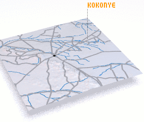 Places with similar names to Kokonye, South Africa ::
Disclaimer :: Information on this page comes without warranty of any kind |
||
|
Where is Kokonye? Elevation and coordinates ::
Latitude (lat): 27°13'0"S Longitude (lon): 23°53'0"E
Elevation (approx.): 1384m (map arrows pan, magnifying glasses zoom) |
||
|
Visiting Kokonye? Hotel/Accommodation ::
Book a hotel in Kokonye Travel Guide ::
rental cars ::
car rental offers GPS waypoint ::
download a GPX waypoint (PoI) of Kokonye for your GPS receiver
|
||