|
search place name
|
||
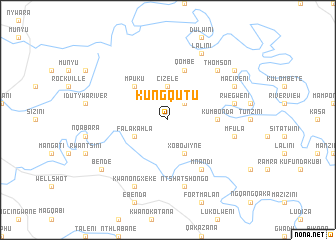
KuNgqutu (South Africa)KuNgqutu is a town in South Africa. An overview map of the region around KuNgqutu is displayed below.
regional and 3d topo map of KuNgqutu, South Africa ::
KuNgqutu airports ::
The nearest airport is UTT - Umtata Mthatha, located 59.8 km north of KuNgqutu.
Other airports nearby include ELS - East London (124.7 km south west), VIY - Bisho Bhisho (147.1 km south west), UTW - Queenstown (153.7 km west), MGH - Margate (220.6 km north east), Nearby towns ::
Sitishini (2.4km north east) //
Cizele (3.7km north) //
Falakahla (3.6km south west) //
Xobojiyne (4.0km south east) //
Mpuku (4.9km north west) //
KuMbonda (4.7km east) //
Qombe (5.8km north) //
Makaka (6.4km south east) //
Mnandi (6.4km south east) //
Ntshatshongo (7.6km south) //
Mfula (6.5km east) //
Rwegweni (6.6km east) //
Thomson (7.3km north east) //
Ndulini (7.3km north east) //
KwaNongxeke (8.1km south west) //
Lalini (8.1km north east) //
Macireni (7.3km north east) //
Collywobbles (8.4km north east) //
Bende (8.4km south west) //
[all distances 'as the bird flies' and approximate] 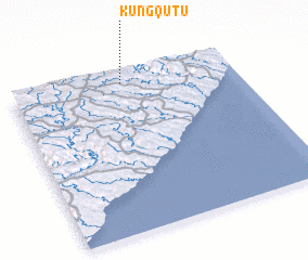 Places with similar names to KuNgqutu, South Africa ::
// Kaongkod (PH)
// KuNgcoti (ZA)
// Kuangkot (TP)
// Cangkudu (ID)
// Konko Koto (GM)
// Konké Kodo (GN)
// Kongokoto (ML)
// Konkoukoutou (ML)
// Công Cô Ðô (VN)
// Kong Cut (VN)
Disclaimer :: Information on this page comes without warranty of any kind |
||
|
Where is KuNgqutu? Elevation and coordinates ::
Latitude (lat): 32°4'0"S Longitude (lon): 28°30'0"E
Elevation (approx.): 715m (map arrows pan, magnifying glasses zoom) |
||
|
Visiting KuNgqutu? Hotel/Accommodation ::
Book a hotel in KuNgqutu Travel Guide ::
rental cars ::
car rental offers GPS waypoint ::
download a GPX waypoint (PoI) of KuNgqutu for your GPS receiver
|
||