|
search place name
|
||
KuXolo (South Africa)KuXolo is a town in South Africa. An overview map of the region around KuXolo is displayed below.
regional and 3d topo map of KuXolo, South Africa ::

KuXolo airports ::
The nearest airport is UTT - Umtata Mthatha, located 75.5 km south of KuXolo.
Other airports nearby include MGH - Margate (136.5 km east), PZB - Pietermaritzburg (198.9 km north east), MSU - Maseru Moshoeshoe I Intl (206.5 km north west), VIY - Bisho Bhisho (270.2 km south west), Nearby towns ::
KuLudwele (0.0km north) //
Magxeni (0.0km north) //
Bhibha (1.6km east) //
Nyalingeni (1.9km north) //
Zidulini (2.4km south west) //
Qunubeni (2.4km south west) //
KuPapana (3.2km east) //
Sigundwaneni (3.7km north) //
Mdeni (4.0km south east) //
KwaDungu (4.0km south east) //
Gala (3.7km south east) //
Moyeni (3.7km south east) //
Ntlanomfula (5.8km north) //
Mbodleni (6.0km north east) //
Toleni (6.4km south west) //
Mount Frere (6.6km east) //
Centuli (7.6km north) //
Gqoloma (6.6km west) //
Bomvini (6.6km west) //
Hohane (7.6km south) //
Bumbeni (7.6km south) //
Lundini (7.3km north east) //
Sirudlwini (8.1km north east) //
Mjikelweni (7.4km north west) //
eNyandeni (8.1km north west) //
Buffalo Nek (8.1km north west) //
Ngqawara (8.8km north west) //
KuBhukazi (8.4km south west) //
Gubhuzi (9.8km north east) //
[all distances 'as the bird flies' and approximate] 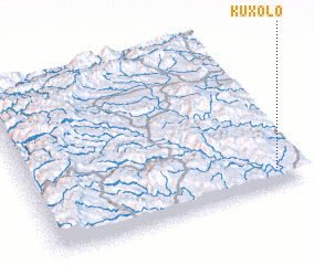 Places with similar names to KuXolo, South Africa ::
Disclaimer :: Information on this page comes without warranty of any kind |
||
|
Where is KuXolo? Elevation and coordinates ::
Latitude (lat): 30°54'0"S Longitude (lon): 28°55'0"E
Elevation (approx.): 1215m (map arrows pan, magnifying glasses zoom) |
||
|
Visiting KuXolo? Hotel/Accommodation ::
Book a hotel in KuXolo Travel Guide ::
rental cars ::
car rental offers GPS waypoint ::
download a GPX waypoint (PoI) of KuXolo for your GPS receiver
|
||