|
search place name
|
||
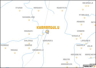
KwaMandulu (South Africa)KwaMandulu is a town in South Africa. An overview map of the region around KwaMandulu is displayed below.
regional and 3d topo map of KwaMandulu, South Africa ::
KwaMandulu airports ::
The nearest airport is MPM - Maputo, located 73.3 km east of KwaMandulu.
Other airports nearby include MTS - Manzini Matsapha (95.8 km south west), SZK - Skukuza (98.4 km north), HDS - Hoedspruit Afb (179.6 km north west), PHW - Phalaborwa (219.7 km north), Nearby towns ::
Figtree (1.7km west) //
KwaSipunu (3.7km south) //
Madadeni (6.7km west) //
Masibekela (8.1km south west) //
Sihlangu (7.6km south west) //
Sikhwahlane (8.7km north west) //
Sibange (8.7km south west) //
[all distances 'as the bird flies' and approximate] 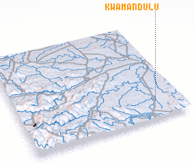 Places with similar names to KwaMandulu, South Africa :: Disclaimer :: Information on this page comes without warranty of any kind |
||
|
Where is KwaMandulu? Elevation and coordinates ::
Latitude (lat): 25°49'0"S Longitude (lon): 31°51'0"E
Elevation (approx.): 266m (map arrows pan, magnifying glasses zoom) |
||
|
Visiting KwaMandulu? Hotel/Accommodation ::
Book a hotel in KwaMandulu Travel Guide ::
rental cars ::
car rental offers GPS waypoint ::
download a GPX waypoint (PoI) of KwaMandulu for your GPS receiver
|
||