|
search place name
|
||
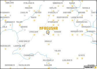
Mfagusha (South Africa)Mfagusha is a town in South Africa. An overview map of the region around Mfagusha is displayed below.
regional and 3d topo map of Mfagusha, South Africa ::
Mfagusha airports ::
The nearest airport is UTT - Umtata Mthatha, located 69.2 km south west of Mfagusha.
Other airports nearby include MGH - Margate (130.7 km east), PZB - Pietermaritzburg (201.0 km north east), MSU - Maseru Moshoeshoe I Intl (217.7 km north west), DUR - Durban Intl (219.8 km north east), Nearby towns ::
KuMahamane (1.9km north) //
Cabane (1.6km west) //
Mpongweni (1.6km east) //
Magqagqeni (2.4km north east) //
Mawula (3.7km south) //
KuPapane (3.2km east) //
KuSusa (3.2km east) //
Mthonjeni (4.0km north east) //
KuSosiba (4.9km north east) //
Zingcuka (4.8km west) //
Magxeni (5.8km north) //
Mtshazi (6.4km north east) //
Mount Frere (7.4km north) //
Nyanzela (7.6km north) //
Mnambithi (7.6km north) //
Ngonyameni (7.3km north east) //
KwaDungu (7.3km north west) //
Mdeni (7.3km north west) //
Moyeni (8.1km north west) //
Gala (8.1km north west) //
Toleni (8.1km south east) //
Hlane (9.8km north east) //
KwaYoba (9.8km north east) //
[all distances 'as the bird flies' and approximate] 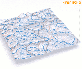 Places with similar names to Mfagusha, South Africa ::
// Meghāgāchha (BD)
Disclaimer :: Information on this page comes without warranty of any kind |
||
|
Where is Mfagusha? Elevation and coordinates ::
Latitude (lat): 30°59'0"S Longitude (lon): 28°59'0"E
Elevation (approx.): 1206m (map arrows pan, magnifying glasses zoom) |
||
|
Visiting Mfagusha? Hotel/Accommodation ::
Book a hotel in Mfagusha Travel Guide ::
rental cars ::
car rental offers GPS waypoint ::
download a GPX waypoint (PoI) of Mfagusha for your GPS receiver
|
||