|
search place name
|
||
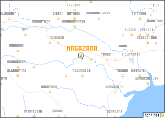
Mngazana (South Africa)Mngazana is a town in South Africa. An overview map of the region around Mngazana is displayed below.
regional and 3d topo map of Mngazana, South Africa ::
Mngazana airports ::
The nearest airport is UTT - Umtata Mthatha, located 61.4 km west of Mngazana.
Other airports nearby include MGH - Margate (129.0 km north east), ELS - East London (210.8 km south west), DUR - Durban Intl (240.4 km north east), PZB - Pietermaritzburg (241.5 km north east), Nearby towns ::
Glengazi (1.6km east) //
Ntsimbini (2.4km north east) //
Ndumakude (3.7km south) //
Mzilanga (3.7km north east) //
Butulo (3.7km north west) //
Ludalasi (4.9km south west) //
Tombo (4.7km east) //
Gxokoza (6.0km north west) //
KwaRela (6.3km east) //
Mvume Springs (7.6km north) //
Dangwana (7.3km north west) //
Umngazana (9.7km south east) //
Kwanyana (9.7km south west) //
[all distances 'as the bird flies' and approximate]  Places with similar names to Mngazana, South Africa ::
// Mangsan (MM)
// Mān Hko-hsan (MM)
// Mennkausen (DE)
// Muncusun (TR)
// Mngazana (ZA)
// Manakasina (MG)
// Manakasina (MG)
// Mangassīn (PK)
// Mangsan (KR)
// Mongsan (KR)
Disclaimer :: Information on this page comes without warranty of any kind |
||
|
Where is Mngazana? Elevation and coordinates ::
Latitude (lat): 31°37'0"S Longitude (lon): 29°19'0"E
Elevation (approx.): 116m (map arrows pan, magnifying glasses zoom) |
||
|
Visiting Mngazana? Hotel/Accommodation ::
Book a hotel in Mngazana Travel Guide ::
rental cars ::
car rental offers GPS waypoint ::
download a GPX waypoint (PoI) of Mngazana for your GPS receiver
|
||