|
search place name
|
||
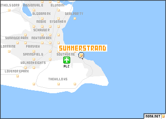
Summerstrand (South Africa)Summerstrand is a town in South Africa. An overview map of the region around Summerstrand is displayed below.
regional and 3d topo map of Summerstrand, South Africa ::
Summerstrand airports ::
The nearest airport is PLZ - Port Elizabeth Intl, located 3.0 km west of Summerstrand.
Other airports nearby include VIY - Bisho Bhisho (193.5 km north east), Nearby towns ::
Humewood (2.4km north west) //
Southdene (3.1km west) //
South End (3.6km north west) //
Hallack Rock (5.0km west) //
Noordhoek (5.8km south) //
Mount Road (5.9km north west) //
Walmer (6.1km west) //
Port Elizabeth (6.4km west) //
Millard Grange (7.2km north west) //
Kensington (7.2km north west) //
North End (7.2km north west) //
The Willows (7.2km south west) //
Glendinningvale (7.2km north west) //
Sydenham (8.7km north west) //
Parsons Hill (8.3km north west) //
Holland Park (8.3km north west) //
McLeanville (8.3km north west) //
Dowerville (8.3km north west) //
Marais (9.6km north west) //
Sidwell (9.6km north west) //
Retiefville (9.6km north west) //
Ferguson (9.6km north west) //
[all distances 'as the bird flies' and approximate] 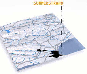 Places with similar names to Summerstrand, South Africa :: Disclaimer :: Information on this page comes without warranty of any kind |
||
|
Where is Summerstrand? Elevation and coordinates ::
Latitude (lat): 33°59'0"S Longitude (lon): 25°39'0"E
Elevation (approx.): 38m (map arrows pan, magnifying glasses zoom) |
||
|
Visiting Summerstrand? Hotel/Accommodation ::
Book a hotel in Summerstrand Travel Guide ::
rental cars ::
car rental offers GPS waypoint ::
download a GPX waypoint (PoI) of Summerstrand for your GPS receiver
|
||