|
search place name
|
||
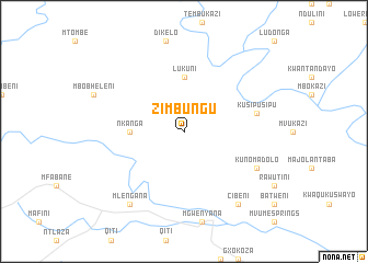
Zimbungu (South Africa)Zimbungu is a town in South Africa. An overview map of the region around Zimbungu is displayed below.
regional and 3d topo map of Zimbungu, South Africa ::
Zimbungu airports ::
The nearest airport is UTT - Umtata Mthatha, located 52.3 km west of Zimbungu.
Other airports nearby include MGH - Margate (126.9 km north east), ELS - East London (217.8 km south west), PZB - Pietermaritzburg (231.2 km north east), DUR - Durban Intl (234.7 km north east), Nearby towns ::
Lukuni (5.6km north) //
Nkanga (4.7km west) //
KuSipusipu (6.6km east) //
KuNomadolo (7.3km south east) //
Cibeni (8.8km south east) //
Mlengana (8.8km south west) //
[all distances 'as the bird flies' and approximate] 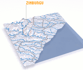 Places with similar names to Zimbungu, South Africa ::
Disclaimer :: Information on this page comes without warranty of any kind |
||
|
Where is Zimbungu? Elevation and coordinates ::
Latitude (lat): 31°28'0"S Longitude (lon): 29°13'0"E
Elevation (approx.): 851m (map arrows pan, magnifying glasses zoom) |
||
|
Visiting Zimbungu? Hotel/Accommodation ::
Book a hotel in Zimbungu Travel Guide ::
rental cars ::
car rental offers GPS waypoint ::
download a GPX waypoint (PoI) of Zimbungu for your GPS receiver
|
||