|
search place name
|
||
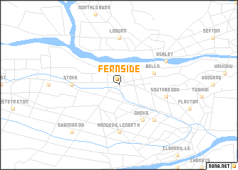
Fernside (Akaroa, New Zealand)Fernside is a town in the Akaroa region of New Zealand. An overview map of the region around Fernside is displayed below.
regional and 3d topo map of Fernside, New Zealand ::
Fernside airports ::
The nearest airport is CHC - Christchurch Intl, located 19.2 km south of Fernside.
Other airports nearby include HKK - Hokitika (142.9 km north west), TIU - Timaru (151.9 km south west), WSZ - Westport (192.0 km north west), OAM - Oamaru (217.3 km south west), Nearby towns ::
Bells (4.5km north east) //
Ohoka (6.2km south east) //
Mandeville North (7.4km south) //
Stoke (5.4km west) //
Loburn (7.4km north) //
Southbrook (5.7km east) //
Wetheral (6.9km south east) //
Ashley (6.5km north east) //
Swannanoa (9.2km south west) //
[all distances 'as the bird flies' and approximate] 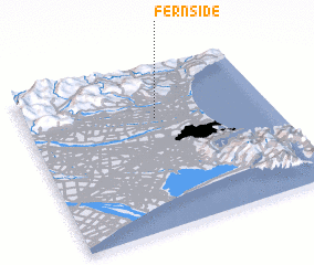 Places with similar names to Fernside, New Zealand ::
// Fornasette (CH)
// Fornacette (IT)
// Verneşti (RO)
// Verneşti (RO)
// Vrăneşti (RO)
// Fernside (NZ)
// Vraništa (MK)
// Fernside (AU)
// Fränsta (SE)
// Vrăneşti (MD)
Disclaimer :: Information on this page comes without warranty of any kind |
||
|
Where is Fernside? Elevation and coordinates ::
Latitude (lat): 43°19'0"S Longitude (lon): 172°32'0"E
Elevation (approx.): 50m (map arrows pan, magnifying glasses zoom) |
||
|
Visiting Fernside? Hotel/Accommodation ::
Book a hotel in Fernside Travel Guide ::
Buy a travel guide for New Zealand rental cars ::
car rental offers GPS waypoint ::
download a GPX waypoint (PoI) of Fernside for your GPS receiver
|
||