|
search place name
|
||
Halswell (Akaroa, New Zealand)Halswell is a town in the Akaroa region of New Zealand. An overview map of the region around Halswell is displayed below.
regional and 3d topo map of Halswell, New Zealand ::

Halswell airports ::
The nearest airport is CHC - Christchurch Intl, located 10.8 km north of Halswell.
Other airports nearby include TIU - Timaru (134.1 km south west), HKK - Hokitika (160.9 km north west), OAM - Oamaru (194.4 km south west), WSZ - Westport (220.3 km north), Nearby towns ::
Wigram (3.9km north) //
Hornby (4.6km north west) //
Ladbrooks (4.6km south west) //
Prebbleton (4.0km west) //
Spreydon (4.4km north east) //
Addington (5.5km north east) //
Cashmere Hills (5.4km east) //
Fendalton (7.9km north) //
Sydenham (6.5km north east) //
Saint Albans (8.4km north east) //
Christchurch (7.7km north east) //
Yaldhurst (8.4km north west) //
[all distances 'as the bird flies' and approximate] 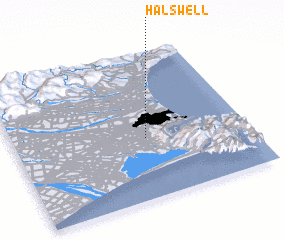 Places with similar names to Halswell, New Zealand :: Disclaimer :: Information on this page comes without warranty of any kind |
||
|
Where is Halswell? Elevation and coordinates ::
Latitude (lat): 43°35'0"S Longitude (lon): 172°34'0"E
Elevation (approx.): 16m (map arrows pan, magnifying glasses zoom) |
||
|
Visiting Halswell? Hotel/Accommodation ::
Book a hotel in Halswell Travel Guide ::
Buy a travel guide for New Zealand rental cars ::
car rental offers GPS waypoint ::
download a GPX waypoint (PoI) of Halswell for your GPS receiver
|
||