|
search place name
|
||
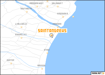
Saint Andrews (Akaroa, New Zealand)Saint Andrews is a town in the Akaroa region of New Zealand. An overview map of the region around Saint Andrews is displayed below.
regional and 3d topo map of Saint Andrews, New Zealand ::
Saint Andrews airports ::
The nearest airport is TIU - Timaru, located 25.8 km north of Saint Andrews.
Other airports nearby include OAM - Oamaru (49.2 km south), MON - Glentanner (109.3 km north west), GTN - Mount Cook (119.8 km north west), WKA - Wanaka (155.2 km west), Nearby towns ::
 Places with similar names to Saint Andrews, New Zealand ::
// Saint Andrews (US)
// Saint Andrews (US)
// Saint Andrews (US)
// Saint Andrews (US)
// Saint Andrews (BB)
// Saint-Ondras (FR)
// Sint-Andries (BE)
// Saint Andrews (CA)
// Saint Andrews (CA)
// Saint Andrews (US)
Disclaimer :: Information on this page comes without warranty of any kind |
||
|
Where is Saint Andrews? Elevation and coordinates ::
Latitude (lat): 44°32'0"S Longitude (lon): 171°11'0"E
Elevation (approx.): 16m (map arrows pan, magnifying glasses zoom) |
||
|
Visiting Saint Andrews? Hotel/Accommodation ::
Book a hotel in Saint Andrews Travel Guide ::
Buy a travel guide for New Zealand rental cars ::
car rental offers GPS waypoint ::
download a GPX waypoint (PoI) of Saint Andrews for your GPS receiver
|
||