|
search place name
|
||
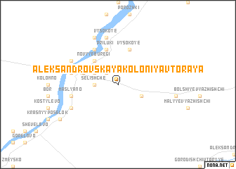
Aleksandrovskaya Koloniya Vtoraya (Novgorodskaya Oblast', Russia)Aleksandrovskaya Koloniya Vtoraya is a town in the Novgorodskaya Oblast' region of Russia. An overview map of the region around Aleksandrovskaya Koloniya Vtoraya is displayed below.
regional and 3d topo map of Aleksandrovskaya Koloniya Vtoraya, Russia ::
Aleksandrovskaya Koloniya Vtoraya airports ::
The nearest airport is LED - St. Petersburg Pulkovo, located 132.1 km north west of Aleksandrovskaya Koloniya Vtoraya.
Nearby towns ::
Fridendorf (2.1km north west) //
Selishche (1.9km west) //
Orel'ye (2.7km north west) //
Aleksandrovskaya Koloniya Pervaya (2.7km south east) //
Novyye Buregi (4.2km north west) //
Priluki (5.6km north) //
Staryye Buregi (3.4km north west) //
Slobodka (3.4km north west) //
Vysokoye (5.6km north) //
Ul'kovo (5.9km north) //
Maslyano (4.3km south west) //
Selishchenskiy (4.3km north west) //
Vysokoye (7.5km north) //
Dubovitsy (5.3km south west) //
Kuzino (5.3km north west) //
Vergezha (7.7km north) //
[all distances 'as the bird flies' and approximate]  Places with similar names to Aleksandrovskaya Koloniya Vtoraya, Russia ::
// Aleksandrovskaya (RU)
// Aleksandrovskaya (RU)
// Aleksandrovskaya (RU)
// Aleksandrovskaya (RU)
// Aleksandrovskaya (RU)
// Aleksandrovskaya (RU)
// Aleksandrovskaya (RU)
// Aleksandrovskaya (RU)
// Aleksandrovskaya Sloboda (RU)
// Aleksandrovskoye (RU)
Disclaimer :: Information on this page comes without warranty of any kind |
||
|
Where is Aleksandrovskaya Koloniya Vtoraya? Elevation and coordinates ::
Latitude (lat): 58°53'0"N Longitude (lon): 31°44'0"E
Elevation (approx.): 35m (map arrows pan, magnifying glasses zoom) |
||
|
Visiting Aleksandrovskaya Koloniya Vtoraya? Hotel/Accommodation ::
Book a hotel in Aleksandrovskaya Koloniya Vtoraya Travel Guide ::
Buy a travel guide for Russia rental cars ::
car rental offers GPS waypoint ::
download a GPX waypoint (PoI) of Aleksandrovskaya Koloniya Vtoraya for your GPS receiver
|
||