|
search place name
|
||
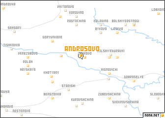
Androsovo (Smolenskaya Oblast', Russia)Androsovo is a town in the Smolenskaya Oblast' region of Russia. An overview map of the region around Androsovo is displayed below.
regional and 3d topo map of Androsovo, Russia ::
Androsovo airports ::
The nearest airport is VTB - Vitebsk, located 119.0 km north west of Androsovo.
Other airports nearby include GME - Gomel (199.7 km south), Nearby towns ::
Zhukovo (0.5km north east) //
Kadino (2.9km west) //
Duravki (3.6km east) //
Bol'shiye Duravki (3.9km east) //
Mignovichi (4.8km south east) //
Bykovo (6.4km north) //
Tatarsk (5.7km south east) //
Starishi (7.3km south) //
Malyye Duravki (4.6km east) //
Rastochina (7.9km north) //
Goryun'kovo (5.8km north west) //
Khot'yany (5.7km south west) //
Staro-Kadino (6.6km south west) //
Kolodino (8.2km north) //
Losevo (7.5km north east) //
Zubovshchina (9.5km south) //
Berëzovka (9.7km south west) //
[all distances 'as the bird flies' and approximate] 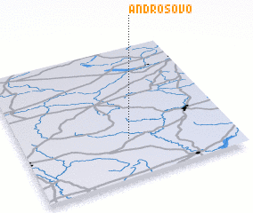 Places with similar names to Androsovo, Russia ::
Disclaimer :: Information on this page comes without warranty of any kind |
||
|
Where is Androsovo? Elevation and coordinates ::
Latitude (lat): 54°17'47"N Longitude (lon): 31°30'44"E
Elevation (approx.): 195m (map arrows pan, magnifying glasses zoom) |
||
|
Visiting Androsovo? Hotel/Accommodation ::
Book a hotel in Androsovo Travel Guide ::
Buy a travel guide for Russia rental cars ::
car rental offers GPS waypoint ::
download a GPX waypoint (PoI) of Androsovo for your GPS receiver
|
||