|
search place name
|
||
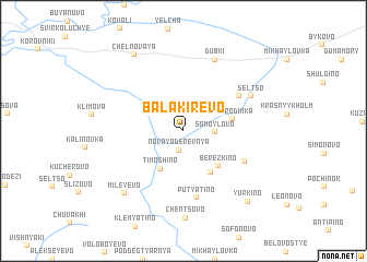
Balakirevo (Smolenskaya Oblast', Russia)Balakirevo is a town in the Smolenskaya Oblast' region of Russia. An overview map of the region around Balakirevo is displayed below.
regional and 3d topo map of Balakirevo, Russia ::
Balakirevo airports ::
The nearest airport is BZK - Bryansk, located 199.2 km south east of Balakirevo.
Nearby towns ::
Novaya Derevnya (2.0km south) //
Samoylovo (1.9km east) //
Borovka (3.0km north west) //
Timoshino (4.1km south) //
Romodanovo (4.5km south) //
Berëzkino (4.2km south east) //
Smorodinka (3.1km east) //
Zaprud'ye (4.8km north east) //
Fëdorovskiye (4.7km south east) //
Putyatino (6.9km south) //
Sel'tso (5.4km north east) //
Dubki (7.5km north) //
Mileyevo (7.3km south west) //
Chentsovo (8.9km south) //
Chëlnovaya (8.3km north) //
Yurkino (8.2km south east) //
[all distances 'as the bird flies' and approximate] 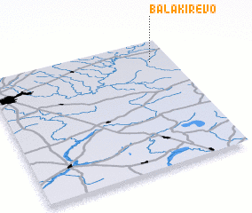 Places with similar names to Balakirevo, Russia ::
// Belle Grove (US)
// Bellgrove (US)
// Bŭlgarevo (BG)
// Bŭlgarovo (BG)
// Belgrove (NZ)
// Balakirevo (RU)
// Balakirevo (RU)
// Belgravia (US)
// Bellegrove (US)
// Bell Grove (US)
Disclaimer :: Information on this page comes without warranty of any kind |
||
|
Where is Balakirevo? Elevation and coordinates ::
Latitude (lat): 54°50'5"N Longitude (lon): 32°53'15"E
Elevation (approx.): 197m (map arrows pan, magnifying glasses zoom) |
||
|
Visiting Balakirevo? Hotel/Accommodation ::
Book a hotel in Balakirevo Travel Guide ::
Buy a travel guide for Russia rental cars ::
car rental offers GPS waypoint ::
download a GPX waypoint (PoI) of Balakirevo for your GPS receiver
|
||