|
search place name
|
||
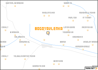
Bogoyavlenka (Bashkortostan, Russia)Bogoyavlenka is a town in the Bashkortostan region of Russia. An overview map of the region around Bogoyavlenka is displayed below.
regional and 3d topo map of Bogoyavlenka, Russia ::
Bogoyavlenka airports ::
The nearest airport is UFA - Ufa, located 138.7 km north east of Bogoyavlenka.
Other airports nearby include REN - Orenburg (229.7 km south), Nearby towns ::
Bizhbulyak (2.2km south west) //
Bazlyk (2.2km north west) //
Barsh (5.0km south east) //
Yegorovka (4.4km east) //
Nikolayevka (7.4km north) //
Kistenli-Bogdanovo (7.5km north) //
Maloye Musino (4.8km north east) //
[all distances 'as the bird flies' and approximate] 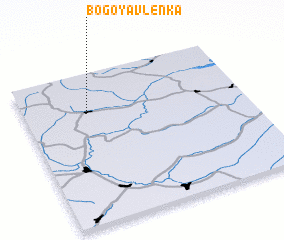 Places with similar names to Bogoyavlenka, Russia ::
// Bogoyavlenka (UA)
// Bogoyavlenka (RU)
// Bogoyavlenka (RU)
// Bogoyavlenka (RU)
// (( Bogoyavlenka )) (RU)
Disclaimer :: Information on this page comes without warranty of any kind |
||
|
Where is Bogoyavlenka? Elevation and coordinates ::
Latitude (lat): 53°44'0"N Longitude (lon): 54°17'0"E
Elevation (approx.): 261m (map arrows pan, magnifying glasses zoom) |
||
|
Visiting Bogoyavlenka? Hotel/Accommodation ::
Book a hotel in Bogoyavlenka Travel Guide ::
Buy a travel guide for Russia rental cars ::
car rental offers GPS waypoint ::
download a GPX waypoint (PoI) of Bogoyavlenka for your GPS receiver
|
||