|
search place name
|
||
Bukhvalovo (Smolenskaya Oblast', Russia)Bukhvalovo is a town in the Smolenskaya Oblast' region of Russia. An overview map of the region around Bukhvalovo is displayed below.
regional and 3d topo map of Bukhvalovo, Russia ::
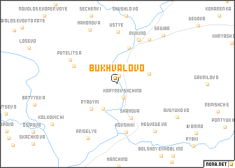
Nearby towns ::
Sorokaren'i (1.3km north) //
Kapyrevshchina (2.2km south) //
Novyye Ryadyni (4.2km south) //
Vasilisina (3.3km north east) //
Ryadyni (4.6km south west) //
Staryye Ryadyni (4.6km south west) //
Shamova (5.6km south) //
Pechenicheno (5.8km north) //
Zadnyaya (4.9km north west) //
Pivkino (7.2km north) //
Kovshiki (7.7km south) //
Maloye Pivkino (7.4km north) //
Ust'ye (8.3km north) //
Potelitsa (5.7km north west) //
Bol'shoye Pivkino (7.7km north) //
Medvedeva (8.3km south east) //
Mamonova (9.0km north) //
Prisel'ye (9.1km south) //
Sediba (8.8km north east) //
[all distances 'as the bird flies' and approximate] 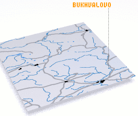 Places with similar names to Bukhvalovo, Russia ::
// Bakhvalovo (RU)
Disclaimer :: Information on this page comes without warranty of any kind |
||
|
Where is Bukhvalovo? Elevation and coordinates ::
Latitude (lat): 55°14'9"N Longitude (lon): 32°51'14"E
Elevation (approx.): 184m (map arrows pan, magnifying glasses zoom) |
||
|
Visiting Bukhvalovo? Hotel/Accommodation ::
Book a hotel in Bukhvalovo Travel Guide ::
Buy a travel guide for Russia rental cars ::
car rental offers GPS waypoint ::
download a GPX waypoint (PoI) of Bukhvalovo for your GPS receiver
|
||