|
search place name
|
||
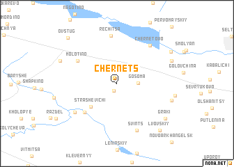
Chernets (Bryanskaya Oblast', Russia)Chernets is a town in the Bryanskaya Oblast' region of Russia. An overview map of the region around Chernets is displayed below.
regional and 3d topo map of Chernets, Russia ::
Chernets airports ::
The nearest airport is BZK - Bryansk, located 18.6 km south east of Chernets.
Nearby towns ::
Chemodurovo (1.2km south) //
Gosoma (2.0km east) //
Strashevichi (4.5km south west) //
Novoye Kaplino (5.6km south west) //
Molotino (5.3km north west) //
Rechitsa (7.6km north) //
Chernetovo (6.8km north east) //
Staroye Kaplino (6.2km south west) //
Svints (7.8km south) //
Sloboda (5.9km south east) //
Gorodets (6.3km north east) //
Graki (7.4km south east) //
Betovo (7.2km north east) //
L'vovskiy (8.6km south east) //
Ovstug (8.7km north west) //
[all distances 'as the bird flies' and approximate] 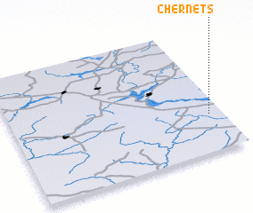 Places with similar names to Chernets, Russia ::
// Chernitsa (BG)
// Chërnitsa (UA)
// Chërnitsa (UA)
// Chërnitsa (UA)
// Chërnitsa (UA)
// Chorna Tysa (UA)
// Chërnitsy (RU)
// Chernitsy (RU)
// Cherntsy (RU)
// Churintzio (MX)
Disclaimer :: Information on this page comes without warranty of any kind |
||
|
Where is Chernets? Elevation and coordinates ::
Latitude (lat): 53°18'4"N Longitude (lon): 33°56'16"E
Elevation (approx.): 184m (map arrows pan, magnifying glasses zoom) |
||
|
Visiting Chernets? Hotel/Accommodation ::
Book a hotel in Chernets Travel Guide ::
Buy a travel guide for Russia rental cars ::
car rental offers GPS waypoint ::
download a GPX waypoint (PoI) of Chernets for your GPS receiver
|
||