|
search place name
|
||
Chernoles'ye (Lipetskaya Oblast', Russia)Chernoles'ye is a town in the Lipetskaya Oblast' region of Russia. An overview map of the region around Chernoles'ye is displayed below.
regional and 3d topo map of Chernoles'ye, Russia ::

Chernoles'ye airports ::
The nearest airport is VOZ - Voronezh Chertovitskoye, located 134.3 km south east of Chernoles'ye.
Nearby towns ::
Zvyagino (2.6km north) //
Malyye Vyselki (1.8km west) //
Yelizavetovka (2.5km east) //
Uvarovka (5.0km north east) //
Krasnaya Pal'na (5.4km south east) //
Uspenskoye (5.9km north) //
Chintsovo (6.2km south) //
Bol'shiye Vyselki (4.5km north west) //
Polevoy (5.5km north west) //
Kalinovka (7.0km south) //
Ivanovka (5.4km south east) //
Borisovo (7.1km north east) //
Samokhvalovka (8.6km south) //
Il'inka (6.6km south east) //
Nikol'skoye (6.4km north east) //
Berëzovaya Roshcha (9.0km south) //
Feodorovka (8.1km south east) //
Kryukovka (8.7km north east) //
Yastrebin Kolodez' (9.9km south west) //
[all distances 'as the bird flies' and approximate] 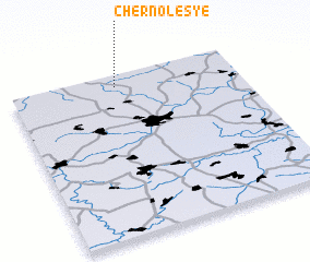 Places with similar names to Chernoles'ye, Russia ::
// Chernoles'ye (RU)
// Chernoles'ye (RU)
Disclaimer :: Information on this page comes without warranty of any kind |
||
|
Where is Chernoles'ye? Elevation and coordinates ::
Latitude (lat): 52°55'37"N Longitude (lon): 38°27'57"E
Elevation (approx.): 223m (map arrows pan, magnifying glasses zoom) |
||
|
Visiting Chernoles'ye? Hotel/Accommodation ::
Book a hotel in Chernoles'ye Travel Guide ::
Buy a travel guide for Russia rental cars ::
car rental offers GPS waypoint ::
download a GPX waypoint (PoI) of Chernoles'ye for your GPS receiver
|
||