|
search place name
|
||
Chinagort (Komi-Permyatskiy Avtonomnyy Okrug, Russia)Chinagort is a town in the Komi-Permyatskiy Avtonomnyy Okrug region of Russia. An overview map of the region around Chinagort is displayed below.
regional and 3d topo map of Chinagort, Russia ::

Chinagort airports ::
The nearest airport is PEE - Perm Bolshoye Savino, located 140.4 km south east of Chinagort.
Nearby towns ::
Petrunevo (2.2km north) //
Zabranovo (2.6km north) //
Fedotovo (1.5km west) //
Stepanovo (1.9km north east) //
Arkhangel'skoye (2.6km south west) //
Karasovo (3.3km north) //
Nizhnyaya Volpa (5.0km north) //
Nikolayevo (3.0km north west) //
Verkhnyaya Volpa (5.5km north) //
Andronovo (3.3km east) //
Kubenevo (3.8km east) //
Zhiganovo (8.3km south) //
Mosino (6.2km north east) //
Sekovo (5.5km south west) //
Kalinino (8.5km north) //
Kray-In'va (6.8km south west) //
[all distances 'as the bird flies' and approximate] 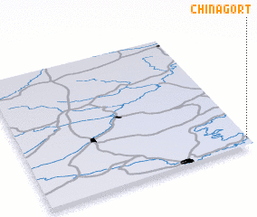 Places with similar names to Chinagort, Russia ::
// Shinkurt (ET)
// Shankardia (BD)
// Chinquirito (CO)
// Chino Gordo (MX)
// Chino Gordo (MX)
// Chino Gordo (MX)
// Shangard (PK)
// Chenicourt (FR)
// Chenicourt (FR)
Disclaimer :: Information on this page comes without warranty of any kind |
||
|
Where is Chinagort? Elevation and coordinates ::
Latitude (lat): 59°3'16"N Longitude (lon): 54°59'39"E
Elevation (approx.): 139m (map arrows pan, magnifying glasses zoom) |
||
|
Visiting Chinagort? Hotel/Accommodation ::
Book a hotel in Chinagort Travel Guide ::
Buy a travel guide for Russia rental cars ::
car rental offers GPS waypoint ::
download a GPX waypoint (PoI) of Chinagort for your GPS receiver
|
||