|
search place name
|
||
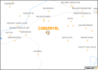
Chodrayal (Mariy-El, Russia)Chodrayal is a town in the Mariy-El region of Russia. An overview map of the region around Chodrayal is displayed below.
regional and 3d topo map of Chodrayal, Russia ::
Chodrayal airports ::
The nearest airport is KZN - Kazan, located 87.5 km south of Chodrayal.
Nearby towns ::
Arino (1.2km north west) //
Kupsola (5.4km north) //
Obdor-Sola (5.5km north) //
Bol'shiye Shali (6.0km north) //
Kozhloyal (4.5km south east) //
Kul'yal (5.3km north east) //
Kul'bash (7.6km south) //
Korkatovo (4.9km west) //
Az”yal (7.0km north east) //
Kumuzh”yal (8.4km north west) //
[all distances 'as the bird flies' and approximate]  Places with similar names to Chodrayal, Russia ::
// Chodrayal (RU)
Disclaimer :: Information on this page comes without warranty of any kind |
||
|
Where is Chodrayal? Elevation and coordinates ::
Latitude (lat): 56°21'6"N Longitude (lon): 48°50'6"E
Elevation (approx.): 196m (map arrows pan, magnifying glasses zoom) |
||
|
Visiting Chodrayal? Hotel/Accommodation ::
Book a hotel in Chodrayal Travel Guide ::
Buy a travel guide for Russia rental cars ::
car rental offers GPS waypoint ::
download a GPX waypoint (PoI) of Chodrayal for your GPS receiver
|
||