|
search place name
|
||
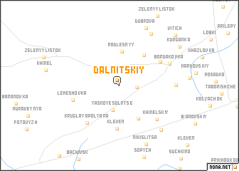
Dal'nitskiy (Bryanskaya Oblast', Russia)Dal'nitskiy is a town in the Bryanskaya Oblast' region of Russia. An overview map of the region around Dal'nitskiy is displayed below.
regional and 3d topo map of Dal'nitskiy, Russia ::
Dal'nitskiy airports ::
The nearest airport is BZK - Bryansk, located 140.8 km north of Dal'nitskiy.
Nearby towns ::
Vesëlaya Kalina (1.7km east) //
Yasnoye Solntse (3.9km south) //
Pozdnyashovka (3.8km north east) //
Podlesnyy (5.3km north) //
Krasnyy Ugolok (5.5km south) //
Voskresenovka (5.3km north east) //
Kleven' (6.7km south) //
Dvadtsatnoye (5.5km north east) //
Lemeshovka (5.1km south west) //
Kruglaya Polyana (6.6km south west) //
Khinel'skiy (6.4km south east) //
Bordakovka (5.9km north east) //
Dobroye Pole (5.5km east) //
Vysokoye Sel'tso (8.7km north) //
Troyebortnoye (8.1km south east) //
Vitich' (9.6km north east) //
[all distances 'as the bird flies' and approximate] 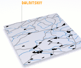 Places with similar names to Dal'nitskiy, Russia :: Disclaimer :: Information on this page comes without warranty of any kind |
||
|
Where is Dal'nitskiy? Elevation and coordinates ::
Latitude (lat): 51°57'9"N Longitude (lon): 34°19'46"E
Elevation (approx.): 193m (map arrows pan, magnifying glasses zoom) |
||
|
Visiting Dal'nitskiy? Hotel/Accommodation ::
Book a hotel in Dal'nitskiy Travel Guide ::
Buy a travel guide for Russia rental cars ::
car rental offers GPS waypoint ::
download a GPX waypoint (PoI) of Dal'nitskiy for your GPS receiver
|
||