|
search place name
|
||
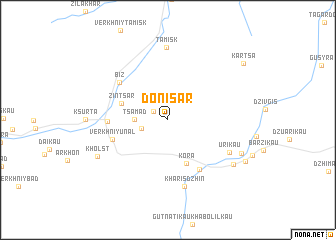
Donisar (Severnaya Osetiya-Alaniya, Russia)Donisar is a town in the Severnaya Osetiya-Alaniya region of Russia. An overview map of the region around Donisar is displayed below.
regional and 3d topo map of Donisar, Russia ::
Donisar airports ::
The nearest airport is MRV - Mineralnye Vody Mineralnyye Vody, located 176.6 km north west of Donisar.
Nearby towns ::
Ursdon (1.6km north west) //
Dagom (2.4km south west) //
Tsamad (2.7km west) //
Kora (5.1km south) //
Zintsar (4.2km north west) //
Verkhniy Unal (5.0km south west) //
Kharisdzhin (6.1km south east) //
Nizhniy Unal (4.9km west) //
Biz (5.7km north west) //
Kharisdzhin (7.5km south) //
Urikau (6.2km south east) //
Tamisk (8.1km north) //
Kholst (7.1km south west) //
Khidikus (7.3km south east) //
Tsmiti (7.1km south east) //
Lats (7.9km south east) //
Kartsa (8.8km north east) //
[all distances 'as the bird flies' and approximate] 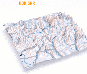 Places with similar names to Donisar, Russia ::
// Tanessar (MA)
// Da-an Sur (PH)
// Dinosaur (US)
// Duna Sor (HU)
// Tõnissaare (EE)
// Danışır (TR)
// Dansür (TR)
// Dansar (IR)
// Deh Naz̄rī (IR)
// Dīneh Sar (IR)
Disclaimer :: Information on this page comes without warranty of any kind |
||
|
Where is Donisar? Elevation and coordinates ::
Latitude (lat): 42°52'0"N Longitude (lon): 44°13'0"E
Elevation (approx.): 2195m (map arrows pan, magnifying glasses zoom) |
||
|
Visiting Donisar? Hotel/Accommodation ::
Book a hotel in Donisar Travel Guide ::
Buy a travel guide for Russia rental cars ::
car rental offers GPS waypoint ::
download a GPX waypoint (PoI) of Donisar for your GPS receiver
|
||