|
search place name
|
||
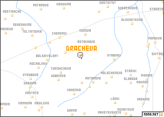
Drachëva (Smolenskaya Oblast', Russia)Drachëva is a town in the Smolenskaya Oblast' region of Russia. An overview map of the region around Drachëva is displayed below.
regional and 3d topo map of Drachëva, Russia ::
Drachëva airports ::
The nearest airport is KLD - Tver Migalovo, located 167.0 km north of Drachëva.
Nearby towns ::
Astakhovo (3.0km north) //
Tararykino (2.6km north west) //
Kurova (5.5km north) //
Dylëvo (5.6km south) //
Turishchëva (4.2km south west) //
Potapovo (5.6km south) //
Trashcheyevo (6.5km south) //
Cherepki (5.7km north west) //
Dobrinka (5.8km south west) //
Ryabinki (4.2km east) //
Lomy Pokrovskiye (6.4km south east) //
Bol'shiye Lomy (4.5km west) //
Molochenevo (5.7km south east) //
Krasnaya Sloboda (5.6km north west) //
Kamenka (8.2km south) //
[all distances 'as the bird flies' and approximate] 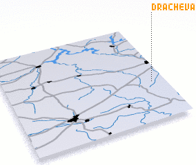 Places with similar names to Drachëva, Russia ::
Disclaimer :: Information on this page comes without warranty of any kind |
||
|
Where is Drachëva? Elevation and coordinates ::
Latitude (lat): 55°24'0"N Longitude (lon): 34°55'0"E
Elevation (approx.): 217m (map arrows pan, magnifying glasses zoom) |
||
|
Visiting Drachëva? Hotel/Accommodation ::
Book a hotel in Drachëva Travel Guide ::
Buy a travel guide for Russia rental cars ::
car rental offers GPS waypoint ::
download a GPX waypoint (PoI) of Drachëva for your GPS receiver
|
||