|
search place name
|
||
Galkino (Kurganskaya Oblast', Russia)Galkino is a town in the Kurganskaya Oblast' region of Russia. An overview map of the region around Galkino is displayed below.
regional and 3d topo map of Galkino, Russia ::
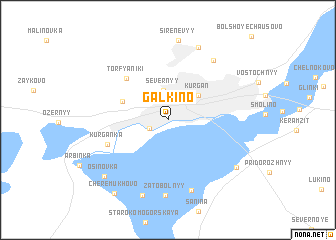
Nearby towns ::
(( Shevelëvka )) (1.5km south west) //
Severnyy (3.3km north) //
Kurgan (3.4km north east) //
Karchevskaya Roshcha (3.6km north west) //
Torfyaniki (5.3km north west) //
Kurganka (4.7km south west) //
Ketovo (8.0km south) //
Inkubator (7.2km north east) //
(( Lesnoy )) (8.4km south) //
(( Zatobol'nyy )) (8.4km south) //
(( Zalesovskiy )) (8.4km south) //
Ryabkovo (8.3km north) //
Nechayevo (8.6km south) //
Sirenevyy (8.9km north) //
Uval (6.8km south east) //
Osinovka (7.5km south west) //
Cherëmukhovo (8.8km south) //
[all distances 'as the bird flies' and approximate] 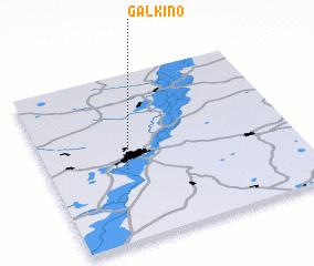 Places with similar names to Galkino, Russia ::
Disclaimer :: Information on this page comes without warranty of any kind |
||
|
Where is Galkino? Elevation and coordinates ::
Latitude (lat): 55°25'32"N Longitude (lon): 65°18'8"E
Elevation (approx.): 74m (map arrows pan, magnifying glasses zoom) |
||
|
Visiting Galkino? Hotel/Accommodation ::
Book a hotel in Galkino Travel Guide ::
Buy a travel guide for Russia rental cars ::
car rental offers GPS waypoint ::
download a GPX waypoint (PoI) of Galkino for your GPS receiver
|
||