|
search place name
|
||
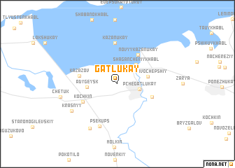
Gatlukay (Adygeya, Russia)Gatlukay is a town in the Adygeya region of Russia. An overview map of the region around Gatlukay is displayed below.
regional and 3d topo map of Gatlukay, Russia ::
Gatlukay airports ::
The nearest airport is KRR - Krasnodar Pashkovskiy, located 16.7 km north of Gatlukay.
Other airports nearby include AER - Sochi (170.2 km south), Nearby towns ::
Pchegatlukay (2.6km east) //
(( Shagancheriykhabl' )) (3.7km north east) //
Adygeysk (3.5km west) //
Novovochepshiy (3.6km east) //
(( Novyy Kazanukay )) (5.2km north east) //
Vochepshiy (4.4km south east) //
Kazazov (4.5km west) //
Kochkin (4.9km south west) //
(( Kazanukay )) (6.5km north) //
Psekups (7.0km south) //
Pritsepilovskaya (7.7km south west) //
Krasnyy (6.7km south west) //
[all distances 'as the bird flies' and approximate]  Places with similar names to Gatlukay, Russia ::
// Catolog (PH)
// Gutalac (PH)
// Kotlik (US)
// Cadillac (US)
// Ca del Lago (IT)
// Ca di Lugo (IT)
// Kotłówka (PL)
// Kotłówka (PL)
// Kudelki (PL)
// Kőtelek (HU)
Disclaimer :: Information on this page comes without warranty of any kind |
||
|
Where is Gatlukay? Elevation and coordinates ::
Latitude (lat): 44°53'30"N Longitude (lon): 39°14'12"E
Elevation (approx.): 27m (map arrows pan, magnifying glasses zoom) |
||
|
Visiting Gatlukay? Hotel/Accommodation ::
Book a hotel in Gatlukay Travel Guide ::
Buy a travel guide for Russia rental cars ::
car rental offers GPS waypoint ::
download a GPX waypoint (PoI) of Gatlukay for your GPS receiver
|
||