|
search place name
|
||
Glukhovo (Tverskaya Oblast', Russia)Glukhovo is a town in the Tverskaya Oblast' region of Russia. An overview map of the region around Glukhovo is displayed below.
regional and 3d topo map of Glukhovo, Russia ::
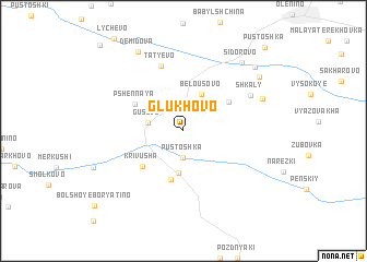
Nearby towns ::
Pustoshka (2.7km south) //
Gusevo (2.2km west) //
Belousovo (3.8km north) //
Kostritsy (4.3km south) //
Yemel'yaninki (5.0km south) //
Repki (3.9km north east) //
Krivusha (4.3km south west) //
Pshennaya (3.9km north west) //
Tat'yevo (6.8km north) //
Shkaly (5.3km north east) //
Komissarovo (5.6km north east) //
Sidorovo (7.7km north east) //
Demidova (8.5km north) //
Borki (7.0km north east) //
Spas Berëza (7.7km north east) //
Pustoshka (9.7km north east) //
Tatevo (10.0km north west) //
[all distances 'as the bird flies' and approximate]  Places with similar names to Glukhovo, Russia ::
Disclaimer :: Information on this page comes without warranty of any kind |
||
|
Where is Glukhovo? Elevation and coordinates ::
Latitude (lat): 56°6'0"N Longitude (lon): 33°23'0"E
Elevation (approx.): 254m (map arrows pan, magnifying glasses zoom) |
||
|
Visiting Glukhovo? Hotel/Accommodation ::
Book a hotel in Glukhovo Travel Guide ::
Buy a travel guide for Russia rental cars ::
car rental offers GPS waypoint ::
download a GPX waypoint (PoI) of Glukhovo for your GPS receiver
|
||