|
search place name
|
||
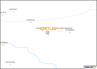
Gortlud (Komi-Permyatskiy Avtonomnyy Okrug, Russia)Gortlud is a town in the Komi-Permyatskiy Avtonomnyy Okrug region of Russia. An overview map of the region around Gortlud is displayed below.
regional and 3d topo map of Gortlud, Russia ::
Gortlud airports ::
The nearest airport is PEE - Perm Bolshoye Savino, located 229.8 km south of Gortlud.
Nearby towns ::
Krasil'nikovo (1.9km north west) //
Bachmanovo (2.3km north east) //
Sredneye-Bachmanovo (3.0km north east) //
Pydosovo (4.2km east) //
Chazevo (5.9km north west) //
[all distances 'as the bird flies' and approximate]  Places with similar names to Gortlud, Russia ::
// Karadulda (TR)
// Kardaletī (ET)
// Garatalata (TD)
// Corte Alto (CL)
// Carretalito (CO)
// Karataldy (KZ)
// Cardalito (PE)
// Cardalito (PE)
// Caratalito (VE)
// Kartlayt (OM)
Disclaimer :: Information on this page comes without warranty of any kind |
||
|
Where is Gortlud? Elevation and coordinates ::
Latitude (lat): 59°50'30"N Longitude (lon): 54°36'2"E
Elevation (approx.): 170m (map arrows pan, magnifying glasses zoom) |
||
|
Visiting Gortlud? Hotel/Accommodation ::
Book a hotel in Gortlud Travel Guide ::
Buy a travel guide for Russia rental cars ::
car rental offers GPS waypoint ::
download a GPX waypoint (PoI) of Gortlud for your GPS receiver
|
||