|
search place name
|
||
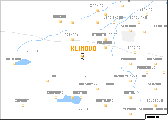
Klimovo (Pskovskaya Oblast', Russia)Klimovo is a town in the Pskovskaya Oblast' region of Russia. An overview map of the region around Klimovo is displayed below.
regional and 3d topo map of Klimovo, Russia ::
Klimovo airports ::
The nearest airport is VTB - Vitebsk, located 131.0 km south of Klimovo.
Nearby towns ::
Zakharovo (1.1km north east) //
Okni (1.2km south east) //
Stepakhino (2.6km west) //
Babino (4.7km south) //
Pozhary (4.8km north) //
Volneino (3.8km north east) //
Staraya Mar'ina (5.3km north east) //
Bol'shaya Pleshkova (6.8km south) //
Rakitino (8.4km south) //
Pesok (8.4km north) //
Petrovshchina (8.5km south) //
Trapezna (8.4km north) //
Koshelëvo (6.5km south west) //
Verkhneye Myatkovo (7.5km south east) //
Son'kino (9.0km north) //
Chuprovo (9.1km south) //
Usadishche (9.1km north east) //
[all distances 'as the bird flies' and approximate]  Places with similar names to Klimovo, Russia ::
Disclaimer :: Information on this page comes without warranty of any kind |
||
|
Where is Klimovo? Elevation and coordinates ::
Latitude (lat): 56°17'32"N Longitude (lon): 30°4'21"E
Elevation (approx.): 191m (map arrows pan, magnifying glasses zoom) |
||
|
Visiting Klimovo? Hotel/Accommodation ::
Book a hotel in Klimovo Travel Guide ::
Buy a travel guide for Russia rental cars ::
car rental offers GPS waypoint ::
download a GPX waypoint (PoI) of Klimovo for your GPS receiver
|
||