|
search place name
|
||
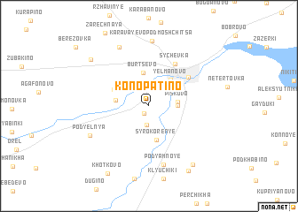
Konopatino (Smolenskaya Oblast', Russia)Konopatino is a town in the Smolenskaya Oblast' region of Russia. An overview map of the region around Konopatino is displayed below.
regional and 3d topo map of Konopatino, Russia ::
Konopatino airports ::
The nearest airport is KLD - Tver Migalovo, located 148.8 km north east of Konopatino.
Nearby towns ::
Toropchino (1.0km south) //
Osinovka (2.4km south) //
Piskovo (2.1km east) //
Zhuchki (2.1km east) //
Lukino (2.5km west) //
Yelmanovo (3.6km north east) //
Burtsevo (4.3km north) //
Syrokoren'ye (4.3km south) //
Kaurovo (3.2km north west) //
Nikolayevka (4.6km north east) //
Sychëvka (5.6km north) //
Pod”yamnoye (7.5km south) //
Karavayevo-Podmoshchitsa (8.2km north) //
Pod”yel'nya (5.6km south west) //
Startsevo (7.7km north) //
Kolpita (8.0km south east) //
Mukovesovo (7.2km north west) //
Ananikha (8.7km south) //
Khot'kovo (9.1km south) //
[all distances 'as the bird flies' and approximate] 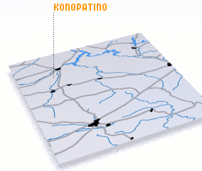 Places with similar names to Konopatino, Russia :: Disclaimer :: Information on this page comes without warranty of any kind |
||
|
Where is Konopatino? Elevation and coordinates ::
Latitude (lat): 55°47'0"N Longitude (lon): 34°15'0"E
Elevation (approx.): 190m (map arrows pan, magnifying glasses zoom) |
||
|
Visiting Konopatino? Hotel/Accommodation ::
Book a hotel in Konopatino Travel Guide ::
Buy a travel guide for Russia rental cars ::
car rental offers GPS waypoint ::
download a GPX waypoint (PoI) of Konopatino for your GPS receiver
|
||