|
search place name
|
||
Kopalëvo (Vologodskaya Oblast', Russia)Kopalëvo is a town in the Vologodskaya Oblast' region of Russia. An overview map of the region around Kopalëvo is displayed below.
regional and 3d topo map of Kopalëvo, Russia ::
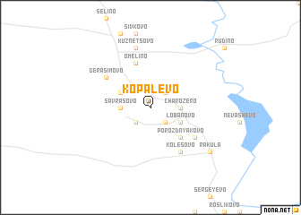
Nearby towns ::
Kolbino (2.1km north east) //
Velikaya (2.1km north east) //
Velikiy Dvor (2.1km south east) //
Kolganovo (2.1km south west) //
Trofimovo (1.8km east) //
Charozero (1.8km east) //
Savrasovo (1.8km west) //
Kletnaya (1.8km west) //
Lobanovo (2.6km south east) //
Kobylino (2.6km north west) //
Porozdnyakovo (4.1km south east) //
Lukanikha (4.1km south east) //
Omelino (5.6km north) //
Kolësovo (5.9km south) //
Gerasimovo (4.6km north west) //
Timofeyevo (4.6km south east) //
Kuznetsovo (7.5km north) //
Rakula (6.7km south east) //
[all distances 'as the bird flies' and approximate] 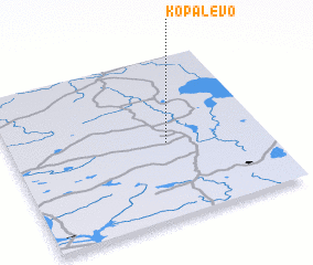 Places with similar names to Kopalëvo, Russia ::
Disclaimer :: Information on this page comes without warranty of any kind |
||
|
Where is Kopalëvo? Elevation and coordinates ::
Latitude (lat): 60°28'0"N Longitude (lon): 38°37'0"E
(map arrows pan, magnifying glasses zoom) |
||
|
Visiting Kopalëvo? Hotel/Accommodation ::
Book a hotel in Kopalëvo Travel Guide ::
Buy a travel guide for Russia rental cars ::
car rental offers GPS waypoint ::
download a GPX waypoint (PoI) of Kopalëvo for your GPS receiver
|
||