|
search place name
|
||
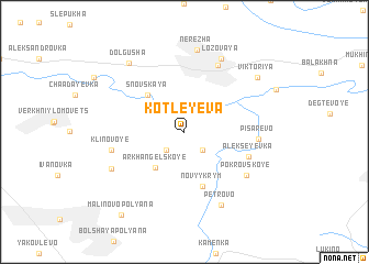
Kotleyeva (Lipetskaya Oblast', Russia)Kotleyeva is a town in the Lipetskaya Oblast' region of Russia. An overview map of the region around Kotleyeva is displayed below.
regional and 3d topo map of Kotleyeva, Russia ::
Kotleyeva airports ::
The nearest airport is VOZ - Voronezh Chertovitskoye, located 57.8 km south east of Kotleyeva.
Nearby towns ::
Bunino (2.2km south west) //
Korovkino (2.2km south east) //
Arkhangel'skoye (4.0km south west) //
Snovskaya (4.3km north west) //
Novyy Krym (5.7km south) //
Alekseyevka (4.8km south east) //
Kalabino (7.0km north) //
Pisarevo (4.7km east) //
Klinovoye (4.9km west) //
Pokrovskoye (5.9km south east) //
Traktor (5.9km south west) //
Petrovo (7.8km south) //
Bekhteyevka (7.8km south) //
Lozovaya (7.8km north) //
Nerezha (8.3km north) //
Dolgusha (7.8km north west) //
Viktoriya (7.2km north east) //
Malinovo Polyana (9.3km south west) //
[all distances 'as the bird flies' and approximate] 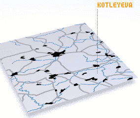
Disclaimer :: Information on this page comes without warranty of any kind |
||
|
Where is Kotleyeva? Elevation and coordinates ::
Latitude (lat): 52°14'0"N Longitude (lon): 38°44'0"E
Elevation (approx.): 184m (map arrows pan, magnifying glasses zoom) |
||
|
Visiting Kotleyeva? Hotel/Accommodation ::
Book a hotel in Kotleyeva Travel Guide ::
Buy a travel guide for Russia rental cars ::
car rental offers GPS waypoint ::
download a GPX waypoint (PoI) of Kotleyeva for your GPS receiver
|
||