|
search place name
|
||
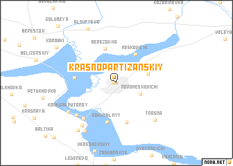
Krasnopartizanskiy (Bryanskaya Oblast', Russia)Krasnopartizanskiy is a town in the Bryanskaya Oblast' region of Russia. An overview map of the region around Krasnopartizanskiy is displayed below.
regional and 3d topo map of Krasnopartizanskiy, Russia ::
Krasnopartizanskiy airports ::
The nearest airport is BZK - Bryansk, located 46.2 km south east of Krasnopartizanskiy.
Nearby towns ::
Tsvetniki (0.0km north) //
Berëzka (0.0km north) //
Zhukovka (0.4km west) //
Novo˙Meskovichi (2.9km south east) //
Sidorovka (3.4km north east) //
Meskovichi (5.0km north) //
Berëzovka (5.7km north) //
Pokhval'nyy (6.4km south) //
Yadrov (6.4km south) //
Vyshkovichi (4.1km west) //
Gostilovka (6.6km south west) //
Melovka (6.4km south west) //
Trosna (7.0km south east) //
Bolshak (7.6km south west) //
Kommunar Vtoroy (6.5km south west) //
Ugost' (8.4km south) //
Shosseynyy Posëlok (8.5km south west) //
Olsuf'yevo (9.1km north) //
[all distances 'as the bird flies' and approximate]  Places with similar names to Krasnopartizanskiy, Russia ::
// Krasnopartizansk (RU)
// Krasnopartizanskiy (RU)
// Krasnopartizanskiy (RU)
// Krasnopartizanskiy (RU)
// Krasnopartizanskiy (RU)
// Krasnopartizanskoye (RU)
// Krasno-Partizanskiy (KZ)
Disclaimer :: Information on this page comes without warranty of any kind |
||
|
Where is Krasnopartizanskiy? Elevation and coordinates ::
Latitude (lat): 53°32'0"N Longitude (lon): 33°44'0"E
Elevation (approx.): 175m (map arrows pan, magnifying glasses zoom) |
||
|
Visiting Krasnopartizanskiy? Hotel/Accommodation ::
Book a hotel in Krasnopartizanskiy Travel Guide ::
Buy a travel guide for Russia rental cars ::
car rental offers GPS waypoint ::
download a GPX waypoint (PoI) of Krasnopartizanskiy for your GPS receiver
|
||