|
search place name
|
||
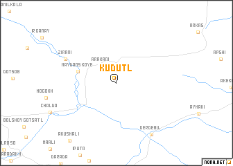
Kudutl' (Dagestan, Russia)Kudutl' is a town in the Dagestan region of Russia. An overview map of the region around Kudutl' is displayed below.
regional and 3d topo map of Kudutl', Russia ::
Kudutl' airports ::
The nearest airport is MCX - Makhachkala Uytash, located 58.3 km north east of Kudutl'.
Nearby towns ::
Arakani (3.2km north west) //
Maydanskoye (4.9km north west) //
Zirani (7.2km north west) //
Gergebil' (9.3km south east) //
[all distances 'as the bird flies' and approximate]  Places with similar names to Kudutl', Russia ::
// Gadiatly (RU)
// Gutatli (RU)
// Katatly (RU)
// Quiet Dell (US)
// Gadey Toulo (TD)
// Gotātola (IN)
// Cuautitla (MX)
// Cuautotola (MX)
// Kattatal (UZ)
// Godatale (LK)
Disclaimer :: Information on this page comes without warranty of any kind |
||
|
Where is Kudutl'? Elevation and coordinates ::
Latitude (lat): 42°34'55"N Longitude (lon): 47°0'56"E
Elevation (approx.): 887m (map arrows pan, magnifying glasses zoom) |
||
|
Visiting Kudutl'? Hotel/Accommodation ::
Book a hotel in Kudutl' Travel Guide ::
Buy a travel guide for Russia rental cars ::
car rental offers GPS waypoint ::
download a GPX waypoint (PoI) of Kudutl' for your GPS receiver
|
||