|
search place name
|
||
Kuglanur (Nizhegorodskaya Oblast', Russia)Kuglanur is a town in the Nizhegorodskaya Oblast' region of Russia. An overview map of the region around Kuglanur is displayed below.
regional and 3d topo map of Kuglanur, Russia ::
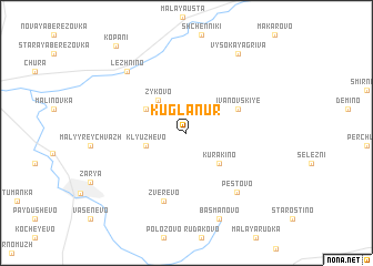
Nearby towns ::
Zykovo (3.6km north west) //
Klyuzhevo (2.6km south west) //
Kurakino (3.6km south east) //
Shabalino (3.3km north west) //
Ivanovskiye (3.7km north east) //
Zverevo (6.9km south) //
Pestovo (6.6km south east) //
Lezhnino (6.9km north west) //
Basmanovo (8.9km south) //
Vysokaya Griva (8.5km north) //
Kopani (9.5km north west) //
[all distances 'as the bird flies' and approximate] 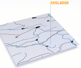 Places with similar names to Kuglanur, Russia :: Disclaimer :: Information on this page comes without warranty of any kind |
||
|
Where is Kuglanur? Elevation and coordinates ::
Latitude (lat): 57°13'41"N Longitude (lon): 46°38'13"E
Elevation (approx.): 129m (map arrows pan, magnifying glasses zoom) |
||
|
Visiting Kuglanur? Hotel/Accommodation ::
Book a hotel in Kuglanur Travel Guide ::
Buy a travel guide for Russia rental cars ::
car rental offers GPS waypoint ::
download a GPX waypoint (PoI) of Kuglanur for your GPS receiver
|
||