|
search place name
|
||
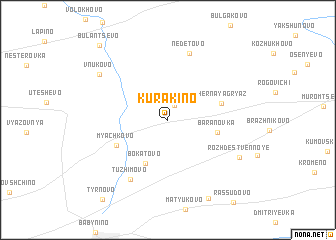
Kurakino (Kaluzhskaya Oblast', Russia)Kurakino is a town in the Kaluzhskaya Oblast' region of Russia. An overview map of the region around Kurakino is displayed below.
regional and 3d topo map of Kurakino, Russia ::
Kurakino airports ::
The nearest airport is VKO - Moscow Vnukovo, located 152.6 km north east of Kurakino.
Other airports nearby include BZK - Bryansk (179.2 km south west), SVO - Moscow Sheremetyevo (192.8 km north east), Nearby towns ::
Volkhonskoye (1.7km north) //
Bokatovo (5.0km south) //
Baranovka (3.5km south east) //
Chërnaya Gryaz' (4.0km north east) //
Myachkovo (4.4km south west) //
Tuzhimovo (7.0km south) //
Nedetovo (7.6km north) //
Rozhdestvennoye (6.3km south east) //
Vnukovo (6.7km north west) //
Dyaglevka (9.2km south) //
Bulantsevo (9.4km north west) //
Tyrnovo (9.8km south west) //
[all distances 'as the bird flies' and approximate] 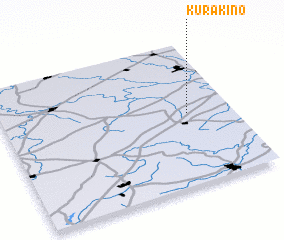 Places with similar names to Kurakino, Russia ::
Disclaimer :: Information on this page comes without warranty of any kind |
||
|
Where is Kurakino? Elevation and coordinates ::
Latitude (lat): 54°30'10"N Longitude (lon): 35°48'37"E
Elevation (approx.): 204m (map arrows pan, magnifying glasses zoom) |
||
|
Visiting Kurakino? Hotel/Accommodation ::
Book a hotel in Kurakino Travel Guide ::
Buy a travel guide for Russia rental cars ::
car rental offers GPS waypoint ::
download a GPX waypoint (PoI) of Kurakino for your GPS receiver
|
||