|
search place name
|
||
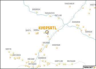
Kversatl' (Dagestan, Russia)Kversatl' is a town in the Dagestan region of Russia. An overview map of the region around Kversatl' is displayed below.
regional and 3d topo map of Kversatl', Russia ::
Kversatl' airports ::
The nearest airport is MCX - Makhachkala Uytash, located 118.2 km north east of Kversatl'.
Nearby towns ::
Khindakh (0.8km south) //
Mikdatl' (1.3km north west) //
Tonokh-Kuli (1.8km south) //
Ieta (3.0km west) //
Charakh (3.0km west) //
Zhalda (3.2km north east) //
Sabda (3.2km west) //
Gozoda (4.3km south) //
Gidatli (4.3km south) //
Tanit (3.5km west) //
Benigib (4.8km south) //
Rosnob (5.9km south) //
Khoroda (5.8km south east) //
Magitl' (6.4km south) //
Kosob (6.9km south) //
Busutli (6.8km south) //
(( Rugudzha )) (7.2km north) //
Svetl' (5.5km west) //
Ratlub (7.0km north east) //
Shidib (7.9km south) //
(( Kul'zeb )) (8.4km south west) //
Dagbash (9.2km north) //
[all distances 'as the bird flies' and approximate] 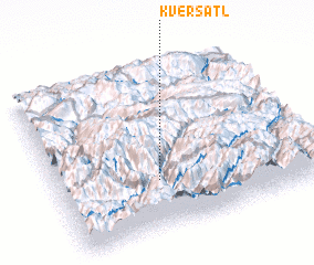 Places with similar names to Kversatl', Russia :: Disclaimer :: Information on this page comes without warranty of any kind |
||
|
Where is Kversatl'? Elevation and coordinates ::
Latitude (lat): 42°18'8"N Longitude (lon): 46°23'33"E
Elevation (approx.): 1877m (map arrows pan, magnifying glasses zoom) |
||
|
Visiting Kversatl'? Hotel/Accommodation ::
Book a hotel in Kversatl' Travel Guide ::
Buy a travel guide for Russia rental cars ::
car rental offers GPS waypoint ::
download a GPX waypoint (PoI) of Kversatl' for your GPS receiver
|
||